Estuary coordinates a joint effort to remotely and continuously monitor the water quality of the San Juan Bay Estuary. This system helps to understand how estuarine water bodies function, behave, and respond, and to evaluate the effectiveness of implemented management actions. It also allows for the identification of pollution problems that may affect people who come into contact with the water, neighboring communities, and aquatic organisms. The information gathered is key to designing solutions aimed at mitigating or eliminating the problems detected and to making decisions based on scientific evidence.
The integration of data from various government entities and agencies, as part of this collaborative effort, provides a broader and clearer view of the health of the estuarine ecosystem. This information is shared on a common platform among the participating institutions, facilitating periodic analysis and ongoing communication about the system's condition.

Water quality monitoring is essential for understanding estuarine ecosystem processes and detecting changes that could affect the health of the ecosystem and neighboring communities. In addition to identifying threats, this monitoring allows for the evaluation of the effectiveness of implemented management actions and provides essential information for designing and integrating mitigation and protection strategies.
Traditionally, water quality data collection is carried out through field visits under favorable conditions: daytime, without rain, and with minimal waves. For safety reasons, measurements are not possible during heavy rain or storms. Thanks to a remote monitoring system that collects data continuously—day and night, even in adverse conditions—information that would otherwise be inaccessible can be obtained.
Changes in water quality caused by accidents, pollutants, or extreme weather events occur rapidly and unpredictably. Continuous remote monitoring systems document these changes in real time, facilitating a better understanding of ecosystem processes, the detection of sudden water quality declines, and timely responses to protect the ecosystem.
The system uses monitoring buoys (DB 600 Xylem) equipped with multiparameter sensors (YSI EXO 2s Sonde) that measure water quality indicators, such as dissolved oxygen, turbidity, pH, temperature, and microalgae concentration, among others. Data is transmitted using technology similar to that of cell phones, and the system operates on solar power. This allows for 24/7 access to the information via a digital application (Hydrosphere), available on mobile phones, tablets, or computers. The system generates records every 15 minutes, enabling precise assessment of the water body's health.
The collected data feeds predictive models that allow for anticipating events such as microalgal blooms, which can produce toxins harmful to water quality and aquatic life. The accuracy and usefulness of these models depend directly on the quality, continuity, and resolution of the data collected by continuous remote monitoring systems.
Thanks to the integration of information from various government entities and agencies, this collaborative effort allows for a comprehensive view of the estuarine ecosystem. Data shared on a common platform facilitates regular analysis, continuous communication, and evidence-based decision-making, strengthening the capacity to respond to changes and extreme events.
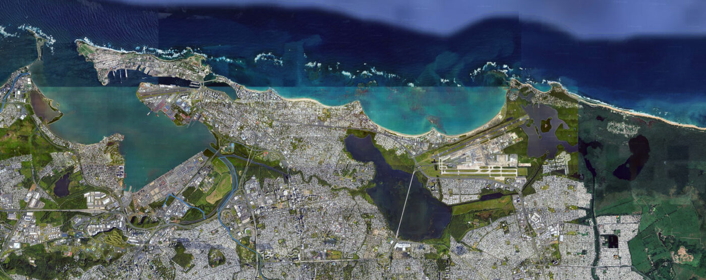
The continuous remote monitoring system will have five buoys equipped with sensors, installed at strategic points in the San Juan Bay Estuary (see Table 1).
Table 1. Water bodies and geographical location of continuous remote monitoring systems.
Body of water | Latitude | Long Jump |
|---|---|---|
Laguna del Condado Estuarine Nature Reserve | 18.458241 | -66.080153 |
river stones | 18.424270 | -66.080916 |
Martín Peña Canal | 18.432777 | -66.060833 |
San José Lagoon | 18.424166 | -66.023611 |
La Torrecilla Lagoon | 18.444104 | -65.981107 |
The selection of locations was based on the following criteria:
The San Juan Bay Estuary is a 501c3 non-profit corporation that designs, implements, and monitors restoration actions to improve water quality and associated ecosystems within the San Juan Bay Estuary system and its watershed.
Receive our weekly update
You will start receiving our updates starting this Friday.